


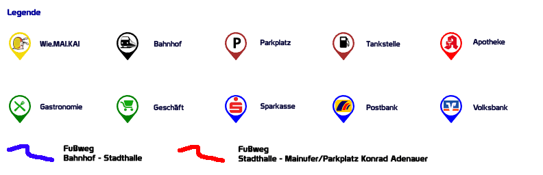
[osm_map lat=“50.016″ lon=“8.427″ zoom=“15″ width=“100%“ height=“600″ kml_file=“../../../../wp-content/uploads/osmdata/floersheim_poi_step.kml“ gpx_file_list=“../../../../wp-content/uploads/osmdata/Fussweg_Stadthalle_-_KonradAdenauerUfer.gpx,../../../../wp-content/uploads/osmdata/Fussweg_Bahnhof_-_Stadthalle.gpx“ gpx_colour_list=“red,blue“ map_border=“thin solid blue“ control=“scaleline,mouseposition“ theme=“ol_orange“ type=“Mapnik“ disc_center_list=“8.422430 50.012154 “ disc_radius_list=“60″]
You are currently viewing a placeholder content from Google Translate. To access the actual content, click the button below. Please note that this will share data with third-party providers.
Further information